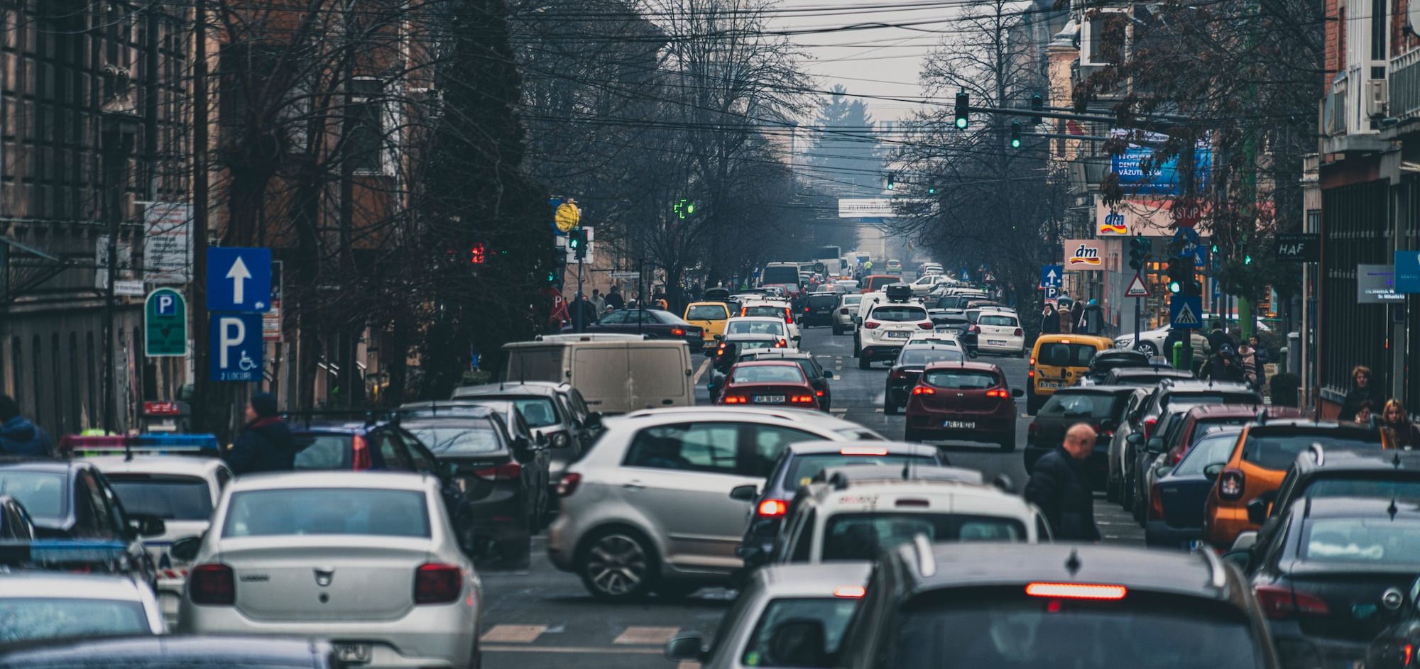
SatNav apps route drivers through residential areas to save seconds from their journeys. As their use accelerates, previously quiet roads are becoming blighted by traffic.
Traffic across Barnsbury and St Mary's is increasing as more and more drivers use the area as a cut-through to avoid main roads. Our residential streets are seeing more and more motor vehicles including the ever increasing numbers of delivery vehicles and Ubers.
One key reason for increased traffic in our neighbourhood is the increased use of SatNav technology. Vehicles that would in the past have remained on main roads are automatically routed via residential roads so that drivers can save as little as a minute or less from their journeys.
Some drivers have always had the local knowledge to travel via residential streets but now these routes are available to all and the apps are universally available on mobile phones.
One example is Uber, which in the past year has unleashed 45,000 new cabs onto London streets, all equipped with satellite navigation and making use of residential streets to save seconds from their journeys.
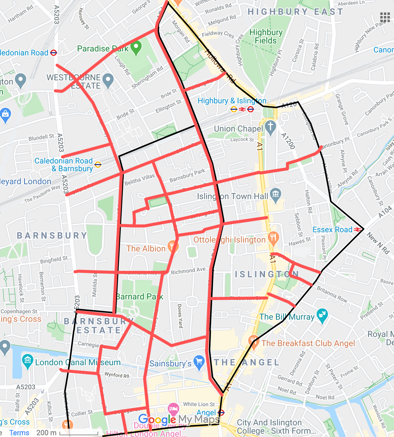
Barnsbury and St Mary's has many examples of this problem. Take two examples:
West-East journeys from York Way to Essex Road
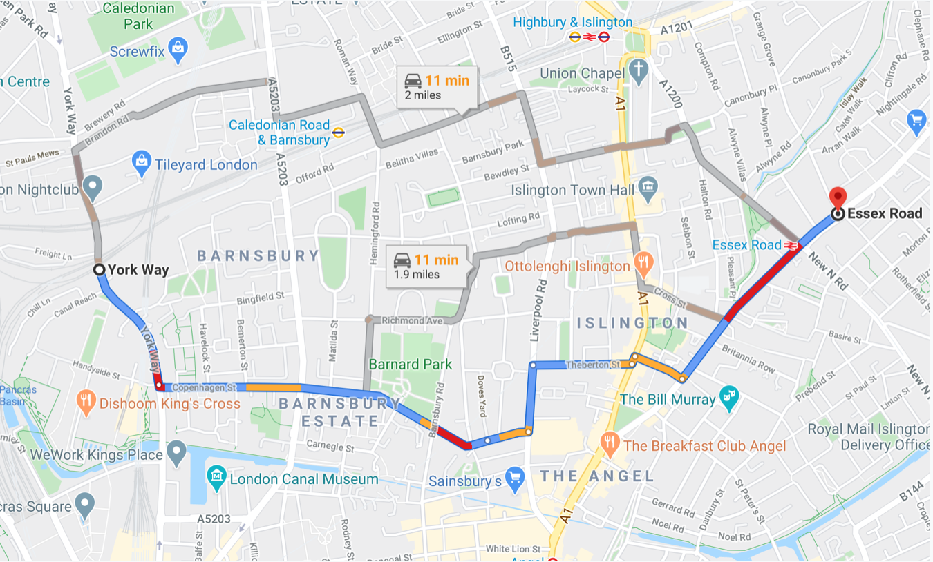
In the past, drivers unfamiliar with the area might have taken the main route to King’s Cross and Angel and then Essex Road which is fully sign-posted. Now there are a number of cut-throughs which their app will suggest:
Copenhagen Street - Cloudesley Place - Liverpool Road - Theberton Street - Gaskin Street
Hemingford Road - Richmond Avenue - Barnsbury Street - Cross Street
Brandon Road - Offord Road - Islington Park Street - Canonbury Lane - Essex Road / Canonbury Place
North-South journeys to/from Archway & Highbury
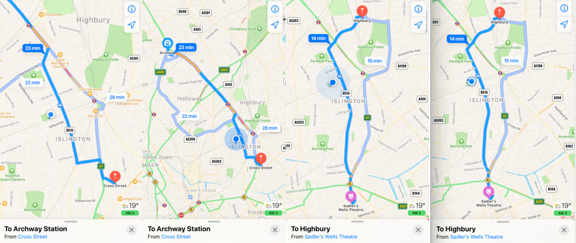
A simple North-South route along Upper Street exists for these journeys. However, improvement works at Highbury Corner combined with SatNav routing means that drivers are increasingly using cut-throughs via residential streets to make small savings in journey time :
Barnsbury Street - Liverpool Road - Offord Road - Roman Way
Islington Park Street - Mackenzie Road - Market Road
Liverpool Road - Palmer Place - Drayton Park
A Lesson from History
Uniquely in Islington, Barnsbury benefited from a partial traffic reduction scheme in the 1960s. Unfortunately, partial implementation has meant that with the rise of satellite navigation, those roads originally excluded from the scheme have become increasingly blighted as traffic levels have risen remorselessly.
For example, Islington Council traffic counts in September 2019 showed that over 21,000 vehicles were using Cloudesley Place (one way) each week.
Bewdley Street (two-way) fared even worse, with over 26,000 vehicles using the road each week.
Time for Action
The increase in traffic is going to get worse as the Covid lockdown eases. We need the council to take action now.
If your residential street is becoming blighted as drivers using it as a cut-through route, please complete our survey so that all affected streets can be captured.
You can make a difference:
- Take our survey
- Read our letter in the Islington Gazette
- Sign up for our newsletter (top right of this page)
- Get in touch: barnsburystmarys@gmail.com